


30-jg

Jack-94
User
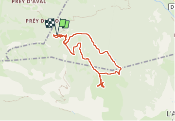

Length
9 km

Max alt
2035 m

Uphill gradient
381 m
Km-Effort
14 km

Min alt
1677 m

Downhill gradient
383 m
Boucle
Yes
Creation date :
2024-06-30 08:48:05.483
Updated on :
2024-06-30 13:27:38.422
4h39
Difficulty : Difficult

FREE GPS app for hiking
 SityTrail
IGN / Geographical institutes
SityTrail Plus
The world is yours!
About
Trail Walking of 9 km to be discovered at Provence-Alpes-Côte d'Azur, Hautes-Alpes, Les Vigneaux. This trail is proposed by Jack-94.
Positioning
Country:
France
Region :
Provence-Alpes-Côte d'Azur
Department/Province :
Hautes-Alpes
Municipality :
Les Vigneaux
Location:
Unknown
Start:(Dec)
Start:(UTM)
303333 ; 4964938 (32T) N.
Comments